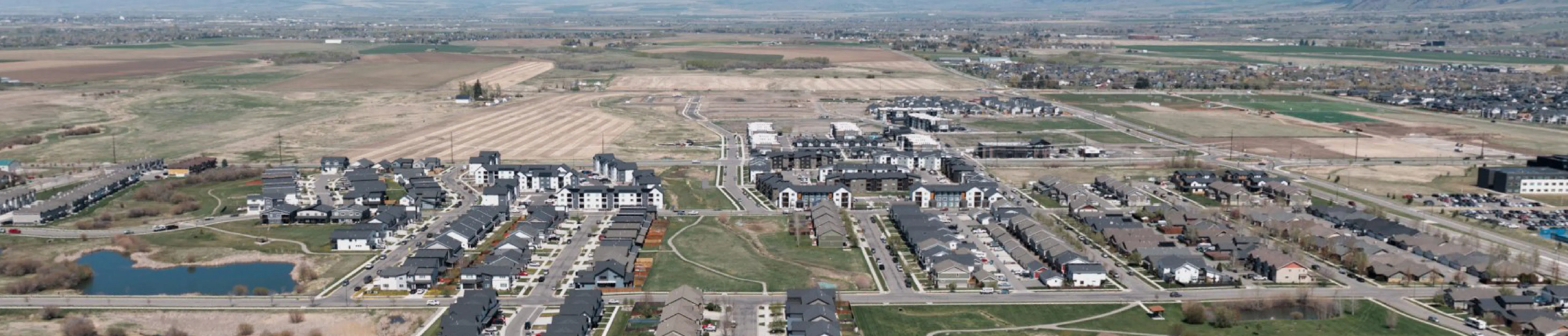
Northwest Bozeman Area Plan

Share Northwest Bozeman Area Plan on Facebook Share Northwest Bozeman Area Plan on X (formerly Twitter) Share Northwest Bozeman Area Plan on Linkedin Email Northwest Bozeman Area Plan link

The City of Bozeman is beginning the Northwest Bozeman Area Plan; a long-range planning effort focused on approximately 3,000 acres in the northwest corner of the City’s growth boundary.

This planning effort is connected to the proposed Gooch Hill Sanitary Sewer Lift Station, which will provide the infrastructure necessary to support future development in this area. While the lift station is a separate engineering project, the Area plan will guide how this area develops after the lift station is operational. The Area plan will address potential land uses, transportation connections, parks and open space, public infrastructure coordination, and protection of natural resources.

The purpose of the Area plan is not to maintain the status quo, but to thoughtfully plan for the area’s transition over time as growth continues. The plan will align with the Bozeman Community Plan and other adopted City plans to ensure future development reflects community priorities and citywide goals.

This is an opportunity to proactively shape one of Bozeman’s key growth areas before development occurs.
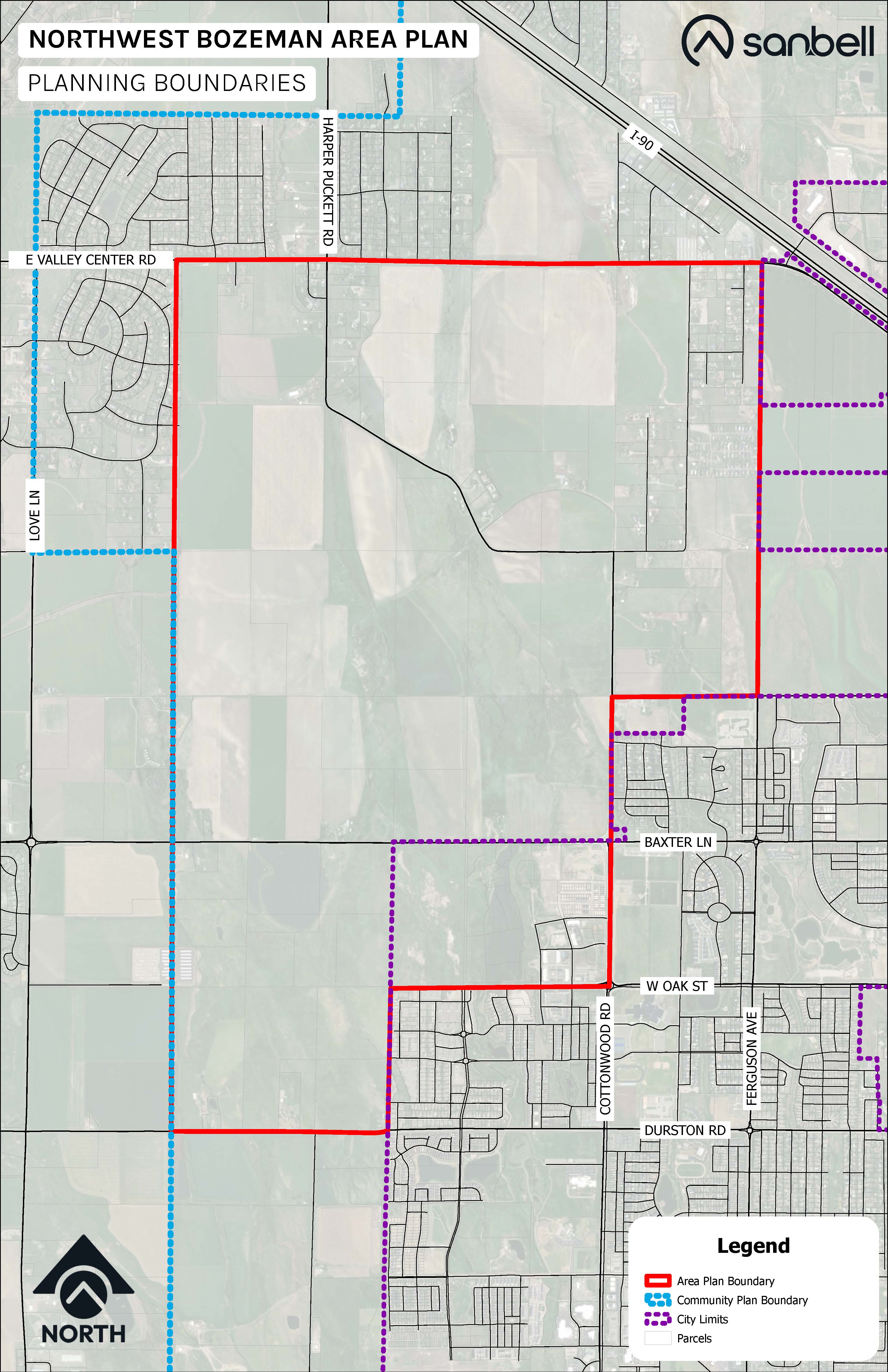

Aerial map of the Northwestern corner of Bozeman with the Northwest Bozeman Area Plan boundary marked in red.

Where We Are Today

The City selected Sanbell, a local community design consulting firm, to develop the Northwest Bozeman Area Plan. Since project kickoff, the team has completed the first phase of community engagement, including stakeholder meetings, public open houses, and a pop-up event at the Bozeman Farmer's Market. These conversations have provided valuable input on community priorities, opportunities, and challenges that will help shape the future of Northwest Bozeman.

The project team is now incorporating this feedback into the draft Northwest Bozeman Area Plan. The draft plan will be released for City staff and community review in the coming weeks, providing another opportunity for community members to review the recommendations and share feedback before the plan is finalized.

Community participation remains a vital part of the planning process, and we appreciate everyone who has contributed their time, ideas, and perspectives. Continued public input will help ensure the final plan reflects the community's vision and provides a clear roadmap for Northwest Bozeman's future.


Why This Plan Matters

As Bozeman continues to grow, it is important to coordinate land use, infrastructure, transportation, parks, and environmental considerations in a thoughtful and transparent way.

This planning process will:

  • Provide clarity about future land uses in northwest Bozeman
  • Identify infrastructure and transportation needs
  • Consider parks, open space, and sensitive lands
  • Build a shared vision for how this area should develop over time

Community participation is essential to ensuring the plan reflects local values and priorities and we encourage you to subscribe to receive project updates.


How to Get Involved

There will be multiple opportunities to participate throughout the planning process, including:

  • Public open houses
  • Pop-up engagement events
  • Online surveys
  • Advisory board meetings
  • City Commission meetings

Meeting dates, materials, and updates will be posted on this page and you can also sign up for updates by hitting the subscribe button on this Engage Bozeman webpage.

The City of Bozeman is beginning the Northwest Bozeman Area Plan; a long-range planning effort focused on approximately 3,000 acres in the northwest corner of the City’s growth boundary.

This planning effort is connected to the proposed Gooch Hill Sanitary Sewer Lift Station, which will provide the infrastructure necessary to support future development in this area. While the lift station is a separate engineering project, the Area plan will guide how this area develops after the lift station is operational. The Area plan will address potential land uses, transportation connections, parks and open space, public infrastructure coordination, and protection of natural resources.

The purpose of the Area plan is not to maintain the status quo, but to thoughtfully plan for the area’s transition over time as growth continues. The plan will align with the Bozeman Community Plan and other adopted City plans to ensure future development reflects community priorities and citywide goals.

This is an opportunity to proactively shape one of Bozeman’s key growth areas before development occurs.


Aerial map of the Northwestern corner of Bozeman with the Northwest Bozeman Area Plan boundary marked in red.

Where We Are Today

The City selected Sanbell, a local community design consulting firm, to develop the Northwest Bozeman Area Plan. Since project kickoff, the team has completed the first phase of community engagement, including stakeholder meetings, public open houses, and a pop-up event at the Bozeman Farmer's Market. These conversations have provided valuable input on community priorities, opportunities, and challenges that will help shape the future of Northwest Bozeman.

The project team is now incorporating this feedback into the draft Northwest Bozeman Area Plan. The draft plan will be released for City staff and community review in the coming weeks, providing another opportunity for community members to review the recommendations and share feedback before the plan is finalized.

Community participation remains a vital part of the planning process, and we appreciate everyone who has contributed their time, ideas, and perspectives. Continued public input will help ensure the final plan reflects the community's vision and provides a clear roadmap for Northwest Bozeman's future.


Why This Plan Matters

As Bozeman continues to grow, it is important to coordinate land use, infrastructure, transportation, parks, and environmental considerations in a thoughtful and transparent way.

This planning process will:

  • Provide clarity about future land uses in northwest Bozeman
  • Identify infrastructure and transportation needs
  • Consider parks, open space, and sensitive lands
  • Build a shared vision for how this area should develop over time

Community participation is essential to ensuring the plan reflects local values and priorities and we encourage you to subscribe to receive project updates.


How to Get Involved

There will be multiple opportunities to participate throughout the planning process, including:

  • Public open houses
  • Pop-up engagement events
  • Online surveys
  • Advisory board meetings
  • City Commission meetings

Meeting dates, materials, and updates will be posted on this page and you can also sign up for updates by hitting the subscribe button on this Engage Bozeman webpage.

Discussions: All (1) Open (1)
  • Share Your Feedback on the Northwest Bozeman Area DRAFT Plan

    about 16 hours ago
    Share Share Your Feedback on the Northwest Bozeman Area DRAFT Plan on Facebook Share Share Your Feedback on the Northwest Bozeman Area DRAFT Plan on X (formerly Twitter) Share Share Your Feedback on the Northwest Bozeman Area DRAFT Plan on Linkedin Email Share Your Feedback on the Northwest Bozeman Area DRAFT Plan link

    You need to be signed in to add your comment.

    The DRAFT Northwest Bozeman Area Plan is ready for your review, and we want to hear from you! The plan is built around a framework map that identifies existing conditions — like natural resources and current infrastructure — alongside potential future public infrastructure. Together, these elements help protect sensitive natural resources and essential infrastructure corridors while guiding where, what type, and how intensely future development should occur.

    To help us organize comments, consider starting your comment with one of the following keywords to indicate which category it relates to:  

    • Natural Resources — Comments on watercourses, wetlands, wildlife habitat, floodplains, and other environmental features shown in the plan.
    • Streets & Utilities — Comments on existing or planned roads, water facilities, and sewer infrastructure.
    • Active Transportation — Comments on shared use paths, natural trails, sidewalks, bike facilities, and other non-motorized connections.
    • Future Land Uses — Comments on proposed development types, locations, and intensity across the planning area.
    • Other — Anything that doesn't fit neatly into the categories above, including general questions or comments about the planning process itself.

    The DRAFT Northwest Bozeman Area Plan is ready for your review, and we want to hear from you! The plan is built around a framework map that identifies existing conditions — like natural resources and current infrastructure — alongside potential future public infrastructure. Together, these elements help protect sensitive natural resources and essential infrastructure corridors while guiding where, what type, and how intensely future development should occur.

    To help us organize comments, consider starting your comment with one of the following keywords to indicate which category it relates to:  

    • Natural Resources — Comments on watercourses, wetlands, wildlife habitat, floodplains, and other environmental features shown in the plan.
    • Streets & Utilities — Comments on existing or planned roads, water facilities, and sewer infrastructure.
    • Active Transportation — Comments on shared use paths, natural trails, sidewalks, bike facilities, and other non-motorized connections.
    • Future Land Uses — Comments on proposed development types, locations, and intensity across the planning area.
    • Other — Anything that doesn't fit neatly into the categories above, including general questions or comments about the planning process itself.

    You need to be signed in to add your comment.

    You need to be signed in to add your comment.

Page last updated: 08 Oct 2026, 11:49 AM